11,331 FEET : Ascent of Telescope Peak from Badwater Basin
March 21-22, 2000
Mike Freedman and Robert Zeithammer
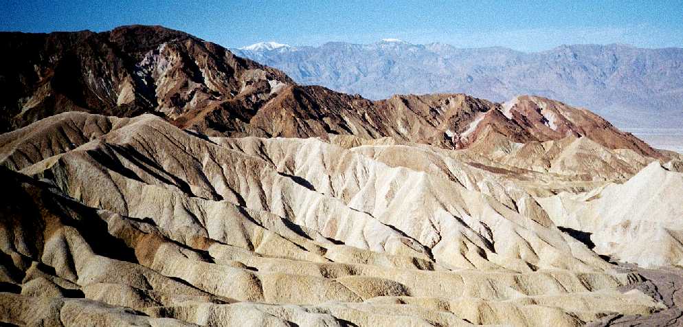
Most people head to Death Valley in search of desolate landscapes, extremely high temperatures, and the lowest point in the Western Hemisphere - Badwater Basin at 282 feet bellow the sea level. But among hikers, the Valley is also known for the mountain that towers over it - Telescope Peak. At 11,049 feet above the sea level, it is not the elevation above sea level that's interesting about it. However, its elevation above valley bottom is the second highest in the lower 48 States (after Rainier). The distance between Badwater and the summit is only about 15 miles as the crow flies which makes for an impressive and sustained ascent...a perfect 2-day break from climbing at Red Rocks over spring break. This trip-report tells our story, you can follow our journey on a
map as you read on. Please click on photos to enlarge them.
![]()
DAY 1: (March 21,2000)
After a short sleep (we spent the previous evening carbo-loading at an all-you-can-eat buffet in Vegas), we got up before 5 AM at the Red Rocks' 13 mile campground and hit the road. With a stop at a supermarket to pick up food for the hike, we used coffee and speeding to arrive in Death Valley just before 8AM.
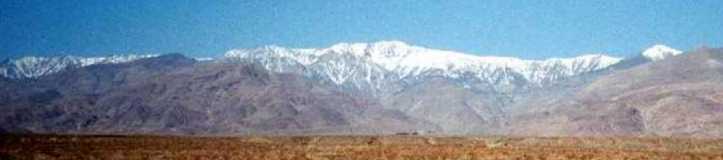
 From Zabriski point, we first saw the snowcapped mountain in the distance."Gluttons for punishment!" said the park rangers when we revealed our plans to them. Unfortunately, none of them has ever climbed the peak even via the easier
tourist route
, so they were not able to tell us anything about the snow conditions. We looked at the mountain again, weighed the snowshoes in our hands, and left them in the car. This gamble actually ended up being the correct choice...
From Zabriski point, we first saw the snowcapped mountain in the distance."Gluttons for punishment!" said the park rangers when we revealed our plans to them. Unfortunately, none of them has ever climbed the peak even via the easier
tourist route
, so they were not able to tell us anything about the snow conditions. We looked at the mountain again, weighed the snowshoes in our hands, and left them in the car. This gamble actually ended up being the correct choice...
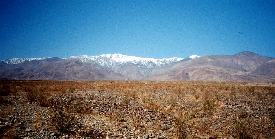 By 10 AM, we reached the junction of the West Side and Hanaupah Canyon roads, parked the car, and started hiking. The mountain seemed very very far away... Luckily, a strong wind was cooling us down as we marched in the intense sun
It took us two hours of walking up a gentle but sustained slope of the Hanaupah Road to reach the mouth of a canyon. We ate lunch, relaxed in a shade of a cliff, refilled our water bottles from an extra gallon jug we carried, and hid the remaining water for the return trip (clever, huh!)
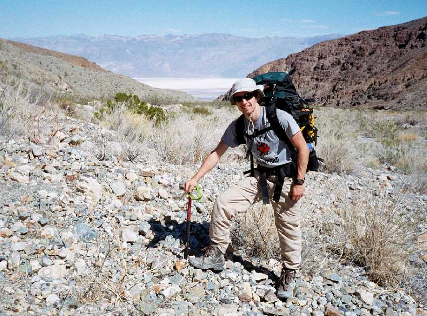
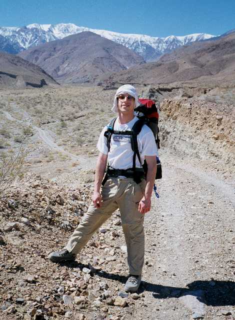 Mike was sporting his makeshift hat that, indeed, look very "ghetto".The mountain did not really seem any closer, but a quick look back confirmed our hopes that we had risen quite a bit from the bottom.
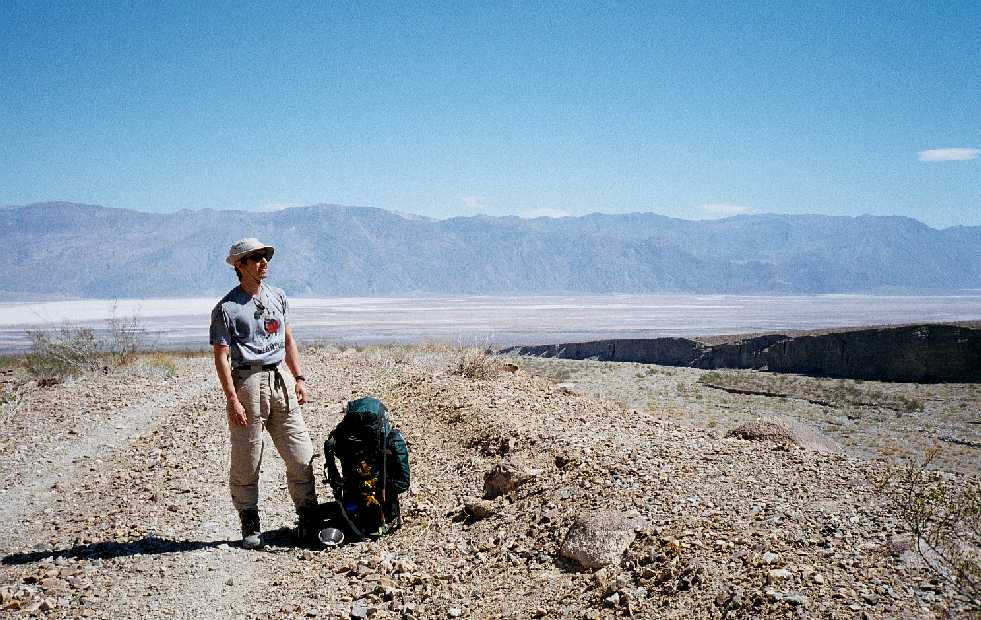
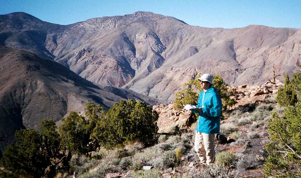
By about 1:30 PM, we had reached the foot of the Central Ridge, about 2000 feet above the valley. With only poor photocopies of the USGS maps (don't try this at home!), we had to read the visible terrain ahead only, and decided to get out of the canyon and take the ridge. Last photo-op before the real climbing began...
 In particular, we were worried about the walls of the canyon becoming too steep and preventing a later ascent. This ended up not being the case, but our route definitely ended up being more scenic with countless views in all directions. From now on, we traveled cross-country, because there are no paths around except for the old dirt road in the canyon. Ice-axes have proven to be great walking sticks as we pushed up the steep ridge.
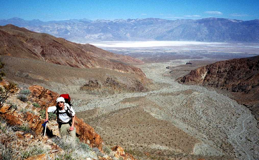
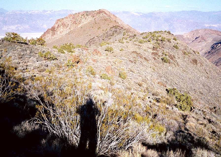
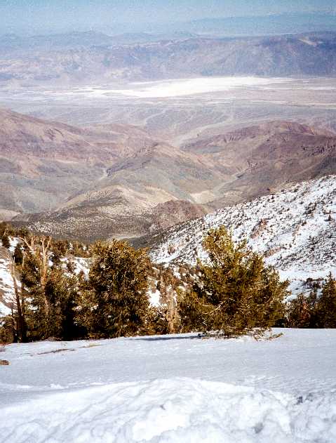
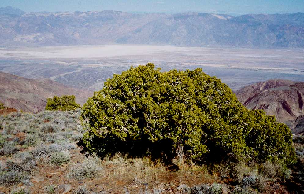 By 3 PM, we had put away about 5000 feet of elevation, and reached the first pronounced summit on the Central Ridge. By now, we were already high enough over the mountains on the opposite side of the valley to see Mount Charleston in the distance. First juniper trees reminded us that we managed to escape the desert and entered the mountain's own ecosystem. It turns out that most precipitation falls on the east slopes we were ascending, because they are in the storm shadow of the peak.
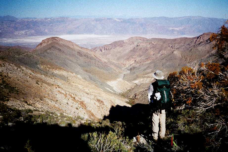
 This was also our first view of the Central Ridge. It rolled up and down towards the mountain between two forks (South and Middle) of the Hanaupah Canyon. The unnecessary elevation loss (at least extra 1000 feet down and up) was a price we had to pay for the scenery
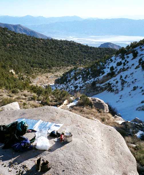
 We pressed on for two more hours, but as the mountain blocked our view of the sun and thus hinted at the nearing sunset, we realized that we were not going to make it to snowline as originally planned. Luckily, we still had enough water for the evening meal, so we decided to camp on the ridge around 5500 feet and hike up to snowline in the morning.
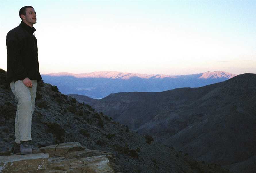 The ramen with sausage tasted great as we watched the sunset light turn distant mountains bright red. The rangers had predicted temperatures about 10 Fahrenheit, so we put on all our clothes, zipped up the tent as much as possible, and generally adopted the winter put-everything-in-your-bag strategy. But the night was actually quite warm (though still definitely freezing), so we didn't have any problems in our 30+ degree bags.
![]()
DAY 2 (March 22)
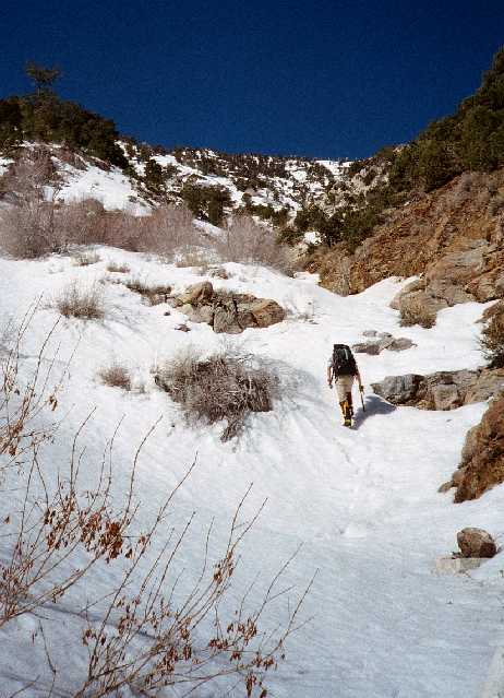
Yes, we were actually hiking at 5AM already, only minutes after crawling out of our sleeping bags and each eating a pop-tart. The ten hours of solid sleep we got rejuvenated our muscles and heightened our spirits. With the minimum necessary gear (snow toys, some wind protection, one stove and one sleeping bag) in our backpacks, we surged up the rest of the ridge. The sun met us around 5:30 AM, and just like in the evening, everything in sight was red.
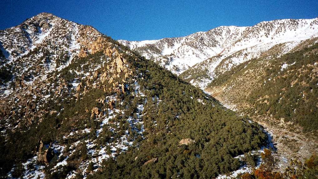 By 7AM, we reached a dense pine forest, so we were glad to see the upmost end of the South Fork canyon, now a shallow wash, ahead of us. And finally, plenty of snow for making water and breakfast!
 Traversing not to lose any elevation, we joined the wash, found a huge boulder, and finally started breakfast preparations. Apple and Cinnamon oatmeal was on the menu. More importantly, we refilled our water bottles with melted snow. I have no idea how can this hike be done in the summer without snow as a day-2 source of water... We concurred that this meal schedule was better than the usual alpine "get up at five, eat immediately, and then go". It was nice to get a long break after the morning 2 hours of hiking and before the last 3500-foot push.
 Around 8:30 AM, with crampons on and self-belaying with ice-axes, we started climbing one of the snow-covered ridges leading to the summit.
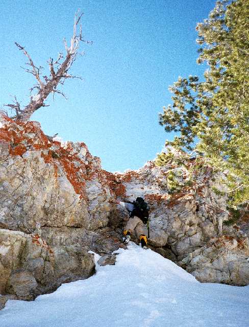 The lack of oxygen slowed us down to the point of stopping after every ten steps or so, the snow was deep in places, and the sunshine intense. Only time-pressure kept our pace up. 4 hours. Not much looking around, not many photos, only one 10-minute breather. Some dry-tooling, though unnecessary and exhausting, was a nice diversion from the monotony.
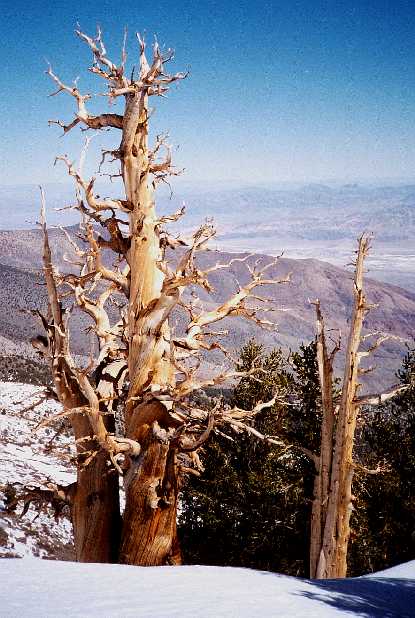 We barely noticed the ancient bristlecone pines around us and the B2 flying overhead... Finally, the summit is in sight. No, it's a false summit. But NOW the summit is in sight...
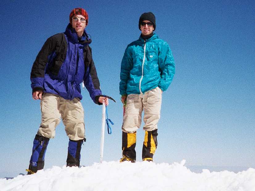 And then, we made it to the top. According to the summit book, we were the first to do so from the valley this winter (and in this millennium!! :-). The weather was warm, the sky completely clear, only a gentle breeze blowing. So gentle that we decided to make hot jello and melt more water right there.
 The views were amazing - Sierra Nevada in the west, Mount Charleston in the east, the entire Death Valley deep bellow us...But the race with darkness was still on, we needed to drop down to the canyon road before dusk. The blitz descent started at 1:30 PM. In fifty minutes, we plunge-stepped what took us over four hours to scramble up.
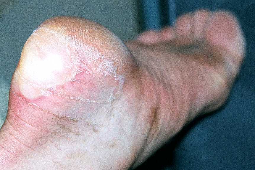
 Then, various short-cuts and traverses brought us back to our camp by 4:30 PM. We packed quickly and plummeted to the canyon floor sliding on huge scree-columns. What looked like a pleasant wide wash from above, was actually a jungle of thorny bushes with a gurgling weed-covered stream in the middle. Goat-like maneuvering on loose conglomerate slopes and lucky route-finding got us out of this mess exactly at 6PM as the sun started to color eastern side of the valley pink. We emerged near an opening of an old mine where the road descends to the canyon floor from its other side. Now, all we had to do was walk 9 miles back to the car along a dirt road. That would be an easy task with a normal dirt road. But this is a vehicle-impassable old mining road with rocks of all sizes strewn everywhere, definitely not a zombie-friendly surface. Nevertheless, with a headlamp on, we made it back to our stashed water, rested, and then pushed all the way back to the car with almost a full moon shining us in the face from the east. Everything hurt, granola bars did NOT taste good anymore, we walked and walked through a featureless plain... Mike's new boots were devastating his heels at every step.
We made it back to the car at 10 PM, 36 hours after leaving it, after a 17-hour day. Still in zombie mode and surprisingly without a major crash, we drove the 15 miles to the Furnace Creek campground, and immediately went to sleep under the stars.
This was a fantastic trip! Would we do it again? Probably not for a while...it's one of those once-in-your-life experiences...
TRIP SUMMARY:
DAY 1 : 6500 feet up, 1000 feet down, about 10 miles hike, 7 hours
DAY 2 : 5500 feet up, 11,300 feet down, about 16 miles hike , 17 hours