| Participants
|
 Hector Briceno
|
 Rob Jagnow
|
 Robert Zeithammer
|
Goal: North-South
Presidential Traverse in 3 days
Reality: Two days of plowing through
knee-deep snow or battling strong winds (or both)
DAY 1:
to Madison via Howker Ridge
The coveted Winter Presidential Traverse
invariably begins from the Appalachia Trailhead (~1300 ft.) with a non-descript
quick ascent to Madison Col via the always-broken super-highway called
"Valley Way". But such a trip does not traverse Mount Madison, and we
believe James Madison was, indeed, a US President, so the mountain named after
him belongs to the Traverse . That's why we chose the innovative route called
"Howker Ridge". It begins at the same trailhead, and takes a sweeping
turn along a ledgy ridge all the way to the summit of Madison (5367 ft.) in
about 5 miles. After some easy-grade
walking on snowshoes through nice powder snow of the valley, we reached the
snow-covered Coosauk Falls, and began the climb. Soon thereafter, we had to
take snowshoes off and scramble up numerous steep sections to the completely
anti-climactic and overgrown Blueberry Ledge (a big part of my marketing of
this route were the supposed views from here...oops!). From this point on, the
vast amounts of snow on the trail raised us all the way to the coniferous
canopy, and much like the Buddhist monks, we were forced to come to absolute
and calm peace with the fact that each touch of a branch would trigger an
avalanche of snow aimed carefully at our heads and necks. And let me tell you,
when you are crawling through dense tree-tops, you have to touch quite a few
branches... All this while struggling at every step to lift each leg high up
only to plunge it back into the virgin snow just a step ahead. And then came
the "Howks" - four cute ledgy knobs with generous elevation-drops in
between (these little saddles are perfect for the accumulation of.... you
guessed it: even more fine fluffy powder snow). Not surprisingly, we lost the
trail just before the summit of the fourth and final Howk, and finding our own
way there though the woods and bushes really taught us to appreciate even the
faint trail we had just been on... Finally we were above treeline, on came the
crampons, and we started putting away the last thousand feet to the summit.
Setting what we believe is a new low-speed-record for everyone involved, we
made it there at average speed 0.5 miles per hour (i.e. in 10 hours from the trailhead),
completely exhausted. How much time did we spend taking breaks? At most an hour
total, this was a determined persistent effort... Descending to the Madison Col
in the dark was uneventful... There, we found a guided party already tucked in,
and after a quick dinner and not-so-quick water-melting, we went to sleep. Upon
return to Boston, we found out that we had used about 10 oz. of fuel per person
this evening and the following morning to melt and heat up something on the
order of 12 quarts of water. That not efficient at all, we have to work on this
problem (cook in a sheltered vestibule of the tent rather than outside, use all
reflector shields, use an insulating base…)
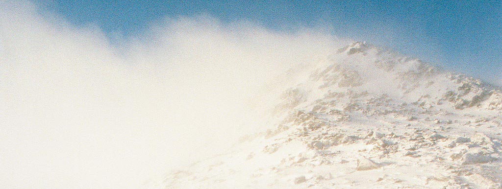
 A view north from the trail
|
 The Howks with Madison still high above us...
|

DAY 2: Up to JQ and down via Durand Ridge
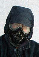
At night, Hector learned an important lesson: non-emergency bivying above treeline in the winter is not a good idea. For those interested in details, he has great stories of spindrift snow constantly hitting his face as it was pumped into his bivysack under the pressure of increasing winds. Putting on his boots sitting up with his face blasted by the gale-force winds was probably not that much fun either. Anyway, we woke up to a nice sunny winter White Mountain day. That means 0 degrees Fahrenheit and winds around 30 MPH (-50 wind-chill). Full windgrear was a must even for basic milling around camp. The summit of JQ Adams right above us had an impressive flag of snow, so we started to doubt our ability to proceed to Lakes of the Clouds that day. Indeed, after reaching the Airline junction on Adams and finding winds strong enough to knock a person over, we decided to just quickly bag JQ and then head down into the trees. The guided party passed us at this point on their way to Edmands Col, good luck to them! The summit of JQ Adams (~5400 ft) offered nice views back to Madison and ahead to Adams, but it was time for us to head down.
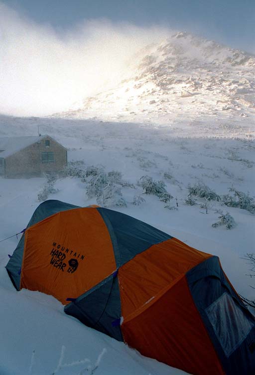 Morning view from camp
|
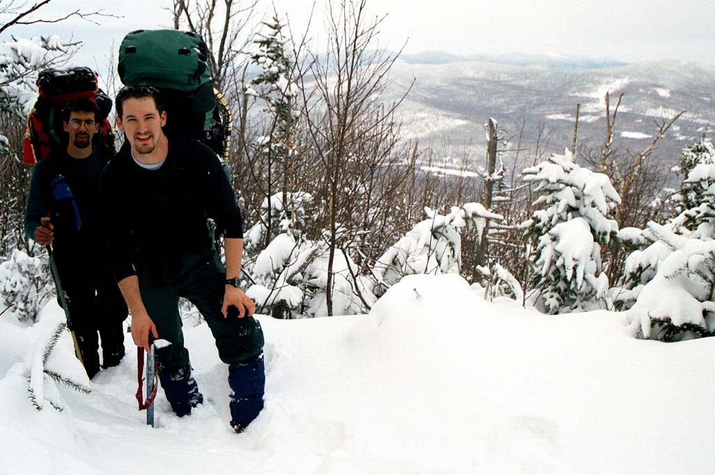
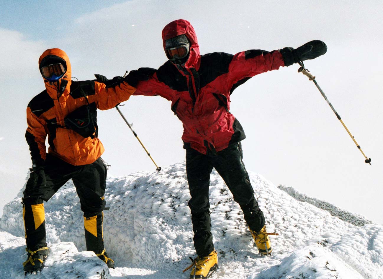 Hector and Robert on JQ flight-simulator
|
Again, we picked a non-standard route - the Airline
Trail, which traverses the beautiful Durand Ridge with views of the majestic
King Ravine on its way bellow treeline. Plan A: take a link trail (Upper Brook
Trail) to the aforementioned Valley Way. The reality: we simply couldn't find
any sign of such a link trail under the immense snowdrifts. Plan B: let's take
the Scar Trail to Valley Way. Over a foot of snow fell the night before, all
that on top of already generous powder layer... We thought that Howker Ridge
was hard, but this was hell! When you are waist-deep in snow WHILE WEARING
SNOWSHOES, you know you are in trouble. Add some crawling under fallen trees
(with 60-pound packs, of course), spice it up with a lost trail, and you have a
full-blown adventure. Interestingly, the worst thing to do was to fall down - getting up without the help of trees or
others was nearly impossible. Just like trying to stand on top of water... But
finally we made it to the nicely packed Valley Way, and before we knew it, we
were back at the car. Despite not completing the original goal, this was a
fantastic trip. I have never seen this much snow in the Whites...
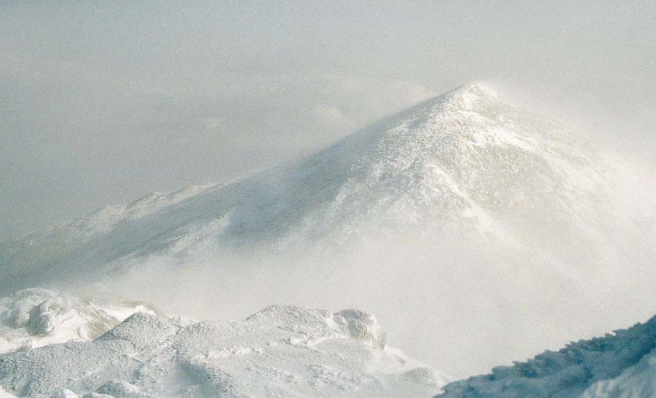
A glimpse of Mount Madison from JQ Adams
Photos by Robert Zeithammer